

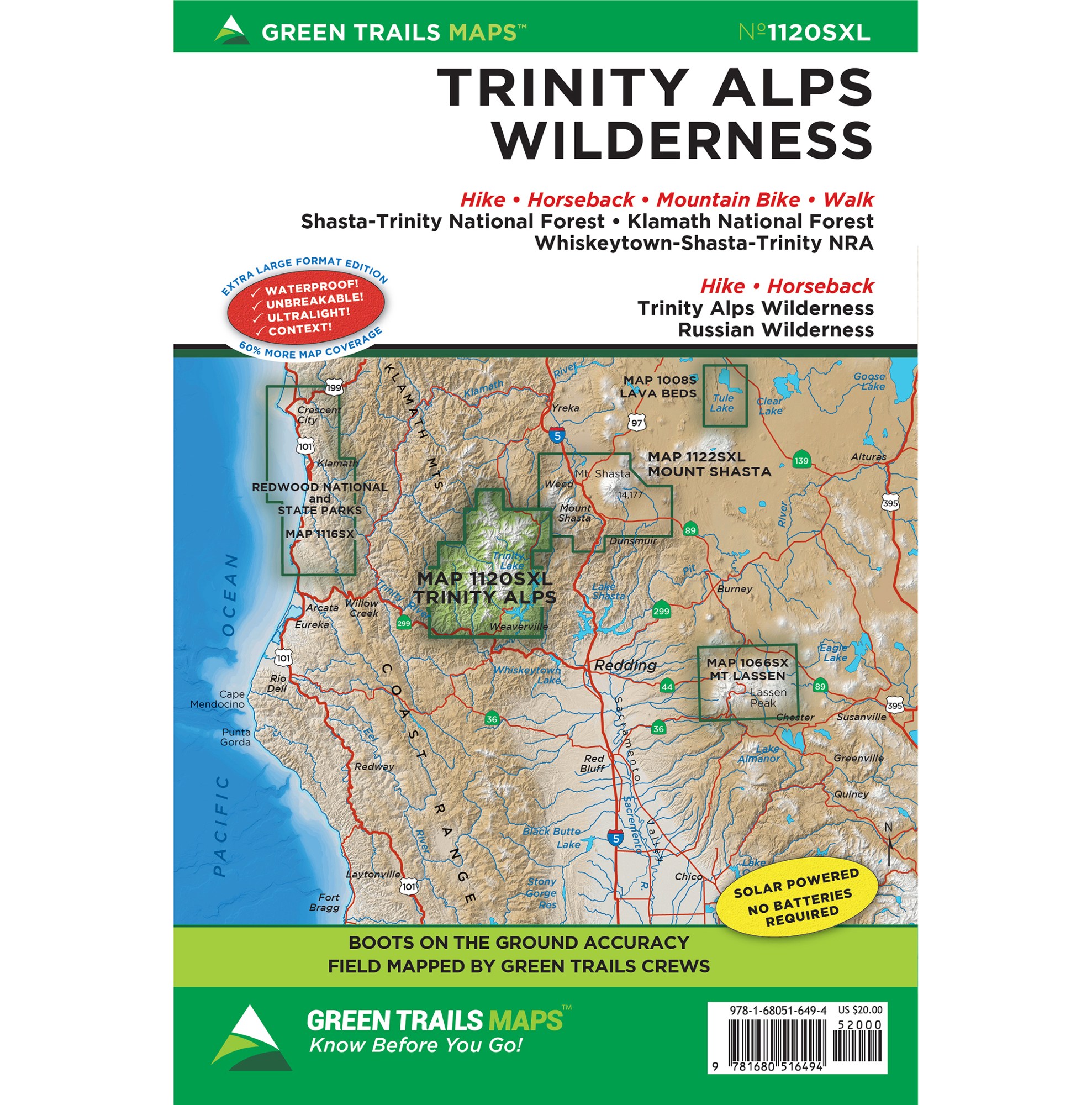
Trinity Alps Wilderness, CA Green Trails Map number 1120SXL
Extra-large 22.5 x 36 unfolded (shipped folded, 6 x 9) waterproof, tear resistant, ultralight map printed on Polyart.
Areas covered:
Shasta-Trinity National Forest
Klamath National Forest
Whiskeytown-Shasta-Trinity NRA
Trinity Alps Wilderness
Russian Wilderness
As every experienced backcountry adventurer knows, possessing solid tools for navigation is one of the Ten Essentials for a safe adventure. There are, of course, many technological options out there, but to truly be prepared there’s really nothing better than a paper map. Fully vetted and high quality, Green Trails maps are not only useful for trip planning but will keep backcountry travelers on track, long after the batteries have died on other navigational devices.Context counts
Each map includes:
Trails coded for hikers only, as well as mountain bikers, stock, skiers, and snowmobilers
Icons for parking and picnic areas, tent camping and RV spaces, bathrooms and backcountry toilets, points of interest, waterfalls, springs, and gates
Dot-to-dot trail distances, contour intervals, adjacent map numbers, and permits required
Land designations: national and state parks, national forest, wilderness, DNR land, private land, tribal land, and others
Map Scale: 1:63360


Reviews
There are no reviews yet.