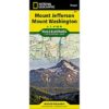


National Geographic Trails Illustrated Mount Jefferson Mount Washington Map
approximate scale 1:75,000
contour interval = 50feet
Map number 819
updated 2014
Waterproof/ Tear proof paper
An indispensable resource when visiting this beautiful region.


National Geographic Trails Illustrated Mount Jefferson Mount Washington Map
scale 1:75000
Waterproof/ Tearproof paper
this map also features the forest services roads and recreational areas surrounding both of these fantastic wilderness areas.
An indispensable resource when visiting this beautiful region.
National Geographic Trails Illustrated Mount Jefferson Mount Washington Map
approximate scale 1:75,000
contour interval = 50feet
Map number 819
updated 2014
Waterproof/ Tear proof paper
An indispensable resource when visiting this beautiful region.
You must be logged in to post a review.


Reviews
There are no reviews yet.